 Rob O'Connor
How do I make sure that my building is facing the right direction?
SketchUp has a handy tool called Geo-Location. This function allows you to start your model from a real green field or to take a slice of planet earth and put it under your building. This can really give context to an analysis and help to sell the vision early on in projects. Here's how to use that functionality with Sefaira's daylight analysis;
Example
I want to drop my model onto the site in a university campus in Dublin, Ireland and find out how much daylight the rooms in my conceptual model will receive. This takes about 5 minutes.
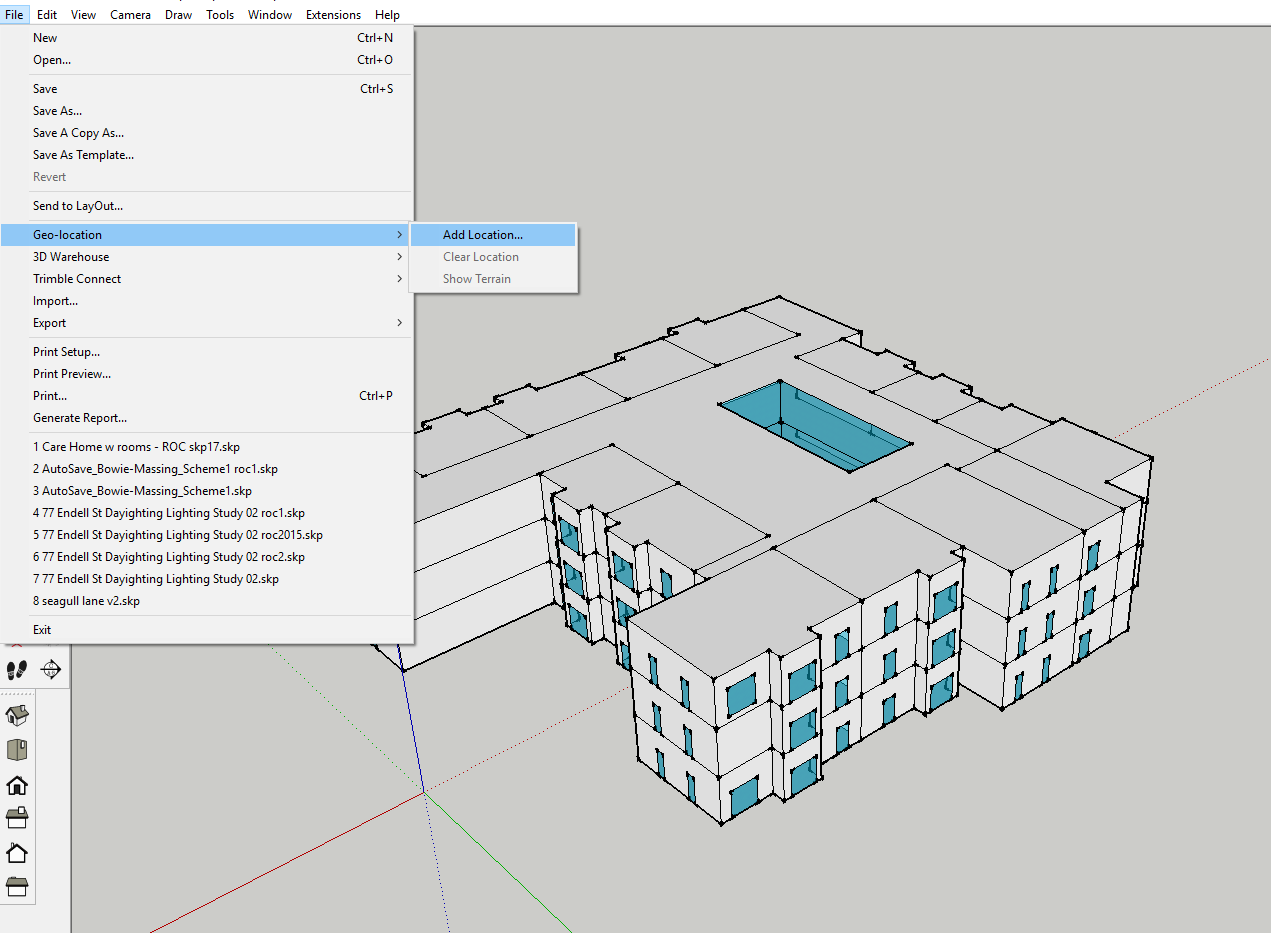
Firstly, add the location by navigating to File > Geo-location > Add Location
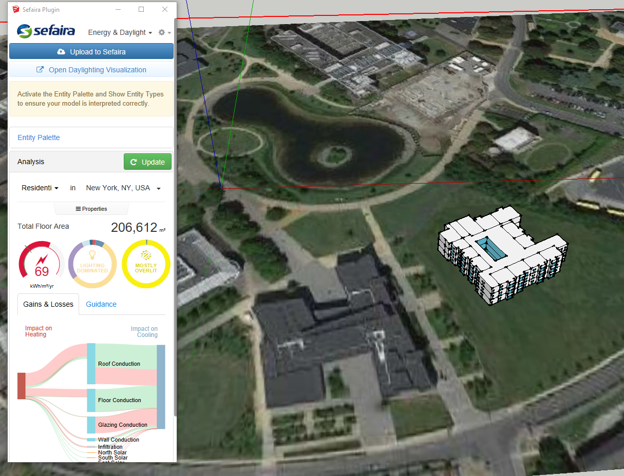
Grab as much or as little of the location as you need and it will paste in under your model. This will be scaled and oriented correctly.
Use the Move and Rotate functions in SketchUp to position your building correctly.

Now, open the Sefaira plugin and Update your first run.
You will notice that we have not adjusted the location in Sefaira which we should do manually - this analysis is located in Dublin but the weather that Sefaira sees is from New York. I do this to highlight that they do not automatically read from each other and the user must change the location in Sefaira also to get the correct analysis.
Also, you may notice that the "Total Floor Area" is very large and that the project is "Mostly Overlit". This is because Sefaira sees the geo-location as a floor that is external and so, sees a lot of light. We will need to address that.
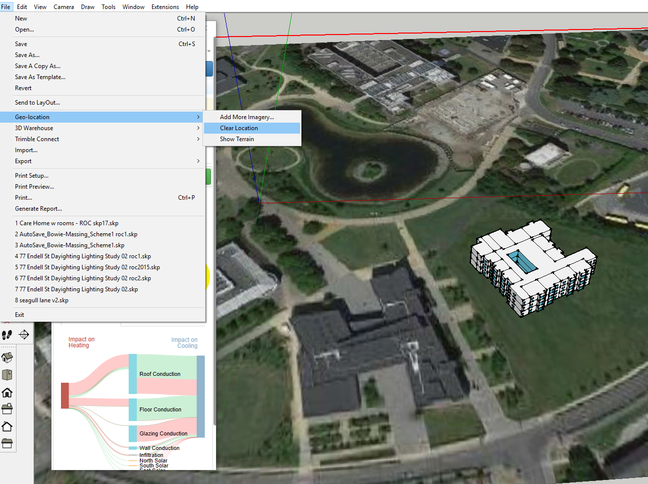
Here, we prepare for a more accurate second run in Sefaira by removing the geo-location. We have the position and any preliminary images that we need so we can get rid of the image and our project will become focused, once again, on the building that we have drawn.
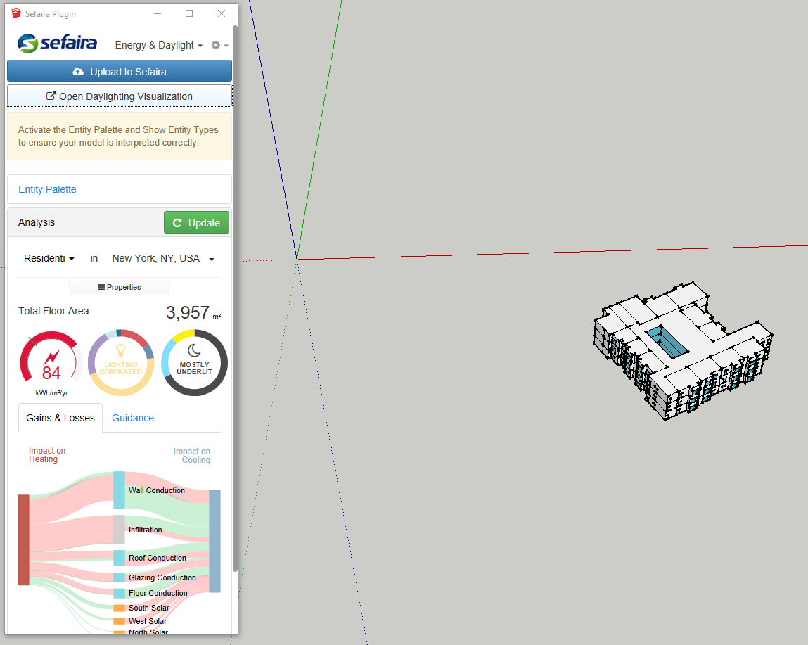
Now, by clicking Update we get results that make a bit more sense!
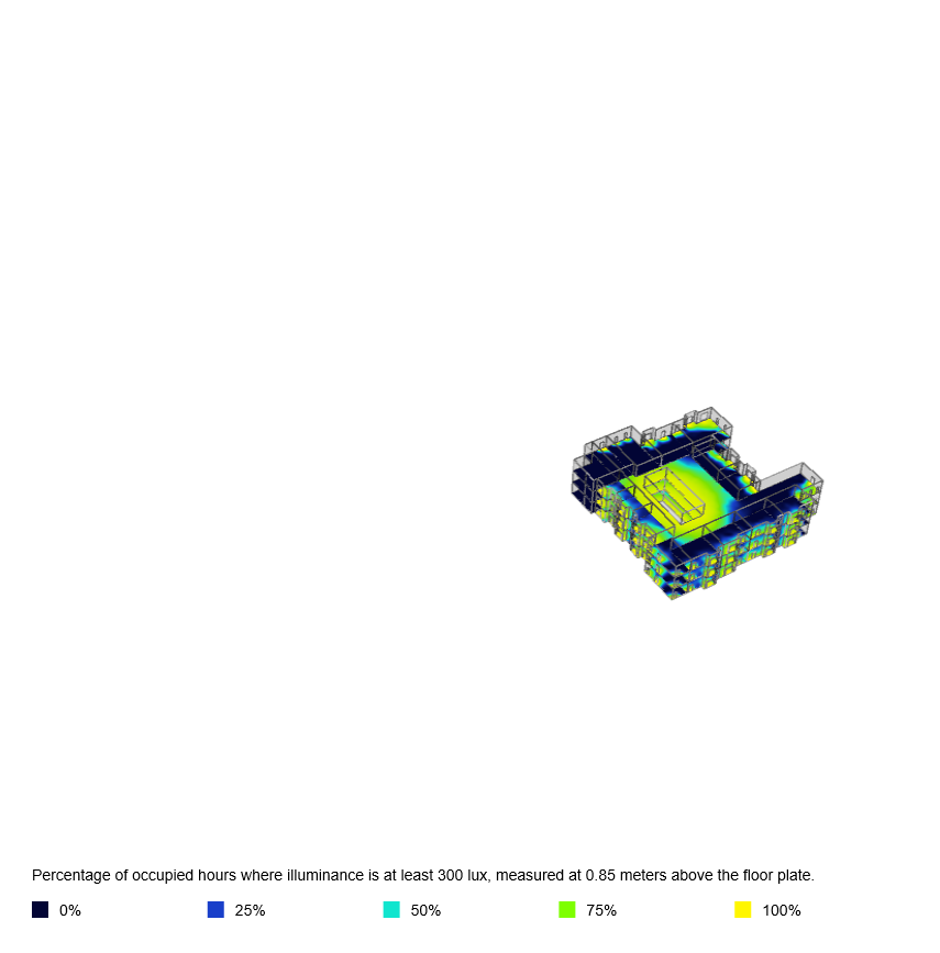
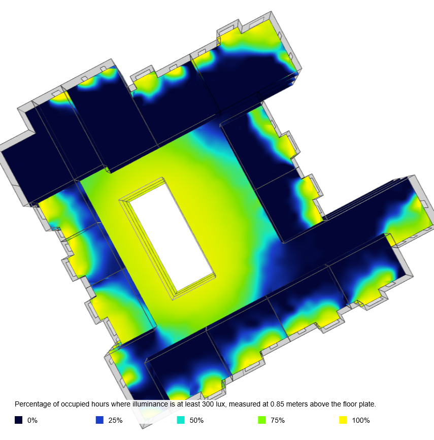
Here are two examples of the output that you can produce from Sefaira. These show a project which is positioned as if it were on the site in Dublin but using a weather file from New York!
Take care to;
- Remove the geo-location before Sefaira Analysis,
- Match the geo-location in SketchUp to the weather file in Sefaira,
- Update the analysis in Sefaira after key changes to get the most accurate results,
- Model your building as close to the origin as possible to centre the downloaded images
Is it possible to leave the geo-location intact while hiding the related Layers from view before running the analysis? Or is it always preferable to remove the geo-location from the File menu? I can assign the terrain and location layers to the "Ignore" entity type, but this appears to slow down the analysis.